This is an accessible version of a virtual tour. It uses high-contrast colors and plain, well-structured HTML and may be used with screen readers. For more information about the standards implemented by this page, please visit the Web Accessibility Initiative by W3C.
For more information about this experience, please contact the creator.
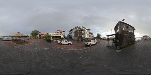
This scene is a image/jpeg type of scene.
It has links to these scenes:
Immersive 360-degree image showing the route along the San Cristóbal boardwalk. Points of interest about local birds and the fishermen’s pier can be seen. via a hotspot placed at {"x":-1619.2644356119315,"y":-191.7517083290809,"z":4777.691868524348}
Immersive 360-degree image showing the route along the San Cristóbal boardwalk. Access points to continue along the boardwalk or enter a side pier can be seen. via a hotspot placed at {"x":1658.5120597619498,"y":-362.04429337853554,"z":-4753.1652273399295}
Immersive 360-degree image showing the Aquarium Pier. Access points to continue the pier route and information about diving activities can be seen. via a hotspot placed at {"x":-5014.920632743685,"y":-334.46115294582586,"z":-456.1143714182472}
It also may have rich content in the form of Infospots.
A ext infospot which contains
{"h1":"Malecón San Cristóbal","h2":"A picturesque coastal promenade that blends nature and urban life. Famous for its close encounters with sea lions, restaurants, craft shops, and scenic ocean views, it is an essential gathering point in Galápagos."}
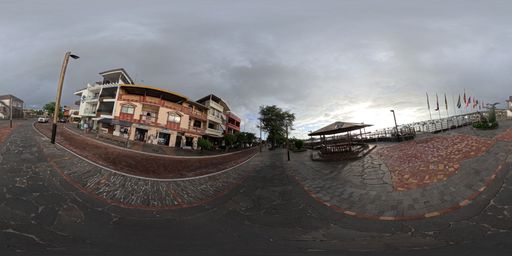
This scene is a image/jpeg type of scene.
It has links to these scenes:
Immersive 360-degree image showing the main section of the San Cristóbal boardwalk. Access points to explore the boardwalk or visit the pier can be seen. via a hotspot placed at {"x":-4594.895470943717,"y":712.6184166315331,"z":1961.675688702639}
Immersive 360-degree image showing the route along the side pier. Points of interest about the water pool that forms on the boardwalk and its characteristics can be seen. via a hotspot placed at {"x":-2259.528855254807,"y":-287.7228395059128,"z":-4503.377815700163}
Immersive 360-degree image showing the exit of the Hammerhead Shark Pier. Access points to continue the San Cristóbal boardwalk route can be seen. via a hotspot placed at {"x":4854.651929240433,"y":-1201.8698469013627,"z":-685.084189573272}
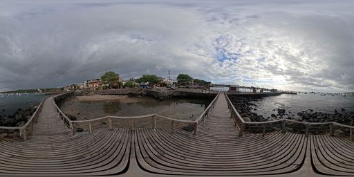
This scene is a image/jpeg type of scene.
It has links to these scenes:
Immersive 360-degree image showing the route along the San Cristóbal boardwalk. Access points to continue along the boardwalk or enter a side pier can be seen. via a hotspot placed at {"x":-3165.4168321964908,"y":-921.7956591667808,"z":3824.1164624764565}
Immersive 360-degree image showing the route along the Hammerhead Shark Pier. Access points to continue exploring the pier or return to the boardwalk route can be seen. via a hotspot placed at {"x":3512.2943503843003,"y":-293.13237786690274,"z":-3612.548322876873}
It also may have rich content in the form of Infospots.
A html infospot which contains
the title of San Cristóbal dock pool and content
A image infospot which contains
{"caption":"The Puerto Baquerizo Moreno boardwalk in San Cristóbal is a vibrant coastal promenade full of life, famous for its friendly sea lions, cafes, shops and unforgettable sunsets over the sea.","previewText":"Panoramic view","image":{"userId":133447,"assetId":"r8HayOhnR","name":"Panorama-MALECON-4.jpg","url":"https://gc.360-data.com/assets/133447/133447-IFAtG5boICu-infospot.jpg","thumbUrl":"https://gc.360-data.com/assets/133447/133447-IFAtG5boICu-thumb.jpg","assetType":"image","createdDate":null,"updatedDate":null,"shared":false,"copyCount":0,"numberOfUsesByTheOwner":0,"id":263663,"lastModifiedDate":"2026-05-14T14:31:33.553Z"}}
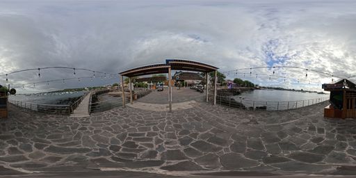
This scene is a image/jpeg type of scene.
It has links to these scenes:
Immersive 360-degree image showing the route along the Hammerhead Shark Pier. Access points to continue exploring the pier or visit the biosecurity agency can be seen. via a hotspot placed at {"x":-4774.476913155336,"y":-1345.5960521060401,"z":940.0963413464374}
Immersive 360-degree image showing the route along the San Cristóbal boardwalk. Points of interest about land transportation and access to continue along the boardwalk can be seen. via a hotspot placed at {"x":5024.971144296445,"y":30.2005090172323,"z":-470.1526940345462}
It also may have rich content in the form of Infospots.
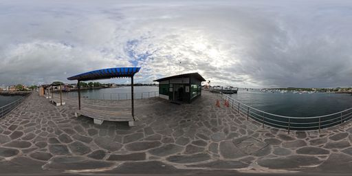
This scene is a image/jpeg type of scene.
It has links to these scenes:
Immersive 360-degree image showing the route along the Hammerhead Shark Pier. Access points to continue exploring the pier or return to the boardwalk route can be seen. via a hotspot placed at {"x":-4047.022469116013,"y":-279.4521368862575,"z":3003.809332806511}
Immersive 360-degree image showing the route along the Hammerhead Shark Pier. Points of interest about maritime transportation can be seen. via a hotspot placed at {"x":4338.8807643527625,"y":-26.83115742659464,"z":-2578.030681717955}
It also may have rich content in the form of Infospots.
A image infospot which contains
{"caption":"Educational image of the Biosecurity Agency. An inspector is seen checking luggage and products at an entry control point. Presents its work to prevent invasive species, protect biodiversity, and keep the Galápagos ecosystems safe.","previewText":"Infographic: Biosecurity Agency","image":{"userId":133447,"assetId":"dNxisFcCy","name":"BIOSECURITYAGENCY.png","url":"https://gc.360-data.com/assets/133447/133447-LM85w2pfHZ-infospot.png","thumbUrl":"https://gc.360-data.com/assets/133447/133447-LM85w2pfHZ-thumb.png","assetType":"image","createdDate":null,"updatedDate":null,"shared":false,"copyCount":0,"numberOfUsesByTheOwner":0,"id":267900,"lastModifiedDate":"2026-06-23T13:55:08.577Z"}}
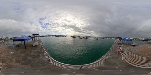
This scene is a image/jpeg type of scene.
It has links to these scenes:
Immersive 360-degree image showing the route along the Hammerhead Shark Pier. Access points to continue exploring the pier or visit the biosecurity agency can be seen. via a hotspot placed at {"x":-4992.268756588169,"y":-748.7772771247107,"z":40.04153774834925}
Immersive 360-degree image showing the route along the Hammerhead Shark Pier. Points of interest about the city airport and fishing boats can be seen. via a hotspot placed at {"x":-350.74596638348936,"y":-404.2801376048733,"z":5020.4272723890945}
Immersive 360-degree image showing the route along the Hammerhead Shark Pier. Points of interest about tourist maritime transportation and waste management can be seen. via a hotspot placed at {"x":-1078.2353885386115,"y":-636.2326721464617,"z":-4889.159349103195}
It also may have rich content in the form of Infospots.
A image infospot which contains
{"caption":"Educational image of inter-island transport. A passenger vessel at the dock is shown, with references to travel between inhabited islands. Presents its importance for connecting communities, facilitating mobility, and supporting responsible and safe tourism across the archipelago.","previewText":"Infographic: Inter-island transport","image":{"userId":133447,"assetId":"hvW4tW_Lj","name":"Interislands.png","url":"https://gc.360-data.com/assets/133447/133447-l3Wkp5p5rm-infospot.png","thumbUrl":"https://gc.360-data.com/assets/133447/133447-l3Wkp5p5rm-thumb.png","assetType":"image","createdDate":null,"updatedDate":null,"shared":false,"copyCount":0,"numberOfUsesByTheOwner":0,"id":267901,"lastModifiedDate":"2026-06-23T13:57:05.981Z"}}
A image infospot which contains
{"caption":"Educational image of the taxi panga. A small boat is seen transporting passengers between the dock and larger vessels. Highlights its role in facilitating boarding and disembarkation, supporting maritime mobility, and promoting safe, orderly, and responsible transport.","previewText":"Infographic: Taxi panga","image":{"userId":133447,"assetId":"SuVUhDYxv","name":"Water taxi.png","url":"https://gc.360-data.com/assets/133447/133447--tnD21URDL-infospot.png","thumbUrl":"https://gc.360-data.com/assets/133447/133447--tnD21URDL-thumb.png","assetType":"image","createdDate":null,"updatedDate":null,"shared":false,"copyCount":0,"numberOfUsesByTheOwner":0,"id":267902,"lastModifiedDate":"2026-06-23T13:58:08.913Z"}}
A image infospot which contains
{"caption":"A taxi panga is a small boat used to transfer passengers between the dock and larger vessels, such as inter-island launches, cruise ships, or cargo boats.","previewText":"Taxi panga","image":{"userId":133447,"shared":false,"assetId":"zIY8YfCae","assetType":"image","name":"Taxi Panga.jpg","url":"https://gc.360-data.com/assets/133447/133447-TDksvCInNzU-infospot.jpg","thumbUrl":"https://gc.360-data.com/assets/133447/133447-TDksvCInNzU-thumb.jpg","createdDate":null,"copyCount":0,"numberOfUsesByTheOwner":1,"picture":null,"userName":"Gabriela","tags":[]}}
A image infospot which contains
{"caption":"Inter-island transport connects the inhabited islands of Galápagos, enabling residents and visitors to travel to nearby destinations such as Santa Cruz, Isabela, and Floreana. On San Cristóbal, agencies selling tickets are usually located near the dock and the waterfront, making it easy to access this service before boarding. The Galápagos Government Council reports that journeys between inhabited islands take approximately 2 to 3 hours, depending on sea conditions.","previewText":"Inter-island transport","image":{"userId":133447,"shared":false,"assetId":"2ZhVXi7sx","assetType":"image","name":"Lancha de Cabotaje.jpg","url":"https://gc.360-data.com/assets/133447/133447-nZcqKY3W1O-infospot.jpg","thumbUrl":"https://gc.360-data.com/assets/133447/133447-nZcqKY3W1O-thumb.jpg","createdDate":null,"copyCount":0,"numberOfUsesByTheOwner":1,"picture":null,"userName":"Gabriela","tags":[]}}
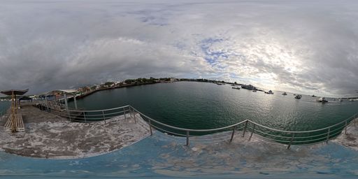
This scene is a image/jpeg type of scene.
It has links to these scenes:
Immersive 360-degree image showing the route along the Hammerhead Shark Pier. Points of interest about maritime transportation can be seen. via a hotspot placed at {"x":-4569.817033178384,"y":-1210.6099262034406,"z":1771.6389054772803}
It also may have rich content in the form of Infospots.
A ext infospot which contains
{"h1":"Airport","h2":"Located 2 minutes from Puerto Baquerizo Moreno, San Cristóbal Airport is the second largest in the Galápagos Islands and features a 1,840-meter-long by 30-meter-wide paved runway."}
A image infospot which contains
{"caption":"Educational image of an artisanal fishing boat. A local vessel is seen at the port, with fishing equipment and the Ecuadorian flag. Presents its importance for food supply, local employment, and the responsible use of marine resources under management regulations.","previewText":"Infographic: Artisanal fishing boat","image":{"userId":133447,"assetId":"Du_9HC8l0","name":"FISHINGBOAT.png","url":"https://gc.360-data.com/assets/133447/133447-4sT4KO8lJL-infospot.png","thumbUrl":"https://gc.360-data.com/assets/133447/133447-4sT4KO8lJL-thumb.png","assetType":"image","createdDate":null,"updatedDate":null,"shared":false,"copyCount":0,"numberOfUsesByTheOwner":0,"id":267903,"lastModifiedDate":"2026-06-23T13:59:51.968Z"}}
A image infospot which contains
{"caption":"Paddle boarding is a common activity around the port, including docks. During your trip, you can observe a variety of species, especially sea lions.","previewText":"Paddle Board","image":{"userId":133447,"assetId":"j6dGrNwYy","name":"Paddle Board.jpg","url":"https://gc.360-data.com/assets/133447/133447-HM17k4eNOl-infospot.jpg","thumbUrl":"https://gc.360-data.com/assets/133447/133447-HM17k4eNOl-thumb.jpg","assetType":"image","createdDate":null,"updatedDate":null,"shared":false,"copyCount":0,"numberOfUsesByTheOwner":0,"id":263790,"lastModifiedDate":"2026-05-15T17:17:16.759Z"}}
A image infospot which contains
{"caption":"Artisanal fishing boats are vessels used by local fishers for fishing activities at sea and for traveling to authorized zones within the Galápagos Marine Reserve. In some cases, these boats may remain at sea for several days, serving as working, resting, and storage spaces during fishing trips.","previewText":"Artisanal fishing boat","image":{"userId":133447,"shared":false,"assetId":"hTSLLrwzf","assetType":"image","name":"Barco de pesca .jpg","url":"https://gc.360-data.com/assets/133447/133447-GJ0BXamvDeG-infospot.jpg","thumbUrl":"https://gc.360-data.com/assets/133447/133447-GJ0BXamvDeG-thumb.jpg","createdDate":null,"copyCount":0,"numberOfUsesByTheOwner":1,"picture":null,"userName":"Gabriela","tags":[]}}
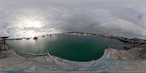
This scene is a image/jpeg type of scene.
It has links to these scenes:
Immersive 360-degree image showing the route along the Hammerhead Shark Pier. Points of interest about maritime transportation can be seen. via a hotspot placed at {"x":-4879.001186797757,"y":-1108.662604120942,"z":668.1089929953864}
It also may have rich content in the form of Infospots.
A image infospot which contains
{"caption":"Educational image of the waste barge. A vessel transporting waste at sea is shown. Presents its role in responsible waste management, reducing marine pollution, and protecting island biodiversity.","previewText":"Infographic: Waste barge","image":{"userId":133447,"assetId":"CHH3Qq2N2","name":"WASTRANSFER.png","url":"https://gc.360-data.com/assets/133447/133447-LJ7alVI8FK-infospot.png","thumbUrl":"https://gc.360-data.com/assets/133447/133447-LJ7alVI8FK-thumb.png","assetType":"image","createdDate":null,"updatedDate":null,"shared":false,"copyCount":0,"numberOfUsesByTheOwner":0,"id":267905,"lastModifiedDate":"2026-06-23T14:03:09.771Z"}}
A image infospot which contains
{"caption":"Educational image of a daily tour boat. A tourist vessel carrying passengers is seen navigating clear waters. Highlights its role in visiting natural sites in a regulated manner, promoting environmental education, and protecting species and habitats through responsible practices.","previewText":"Infographic: Daily tour boats","image":{"userId":133447,"assetId":"gf8YVu0CT","name":"TOURBOAT.png","url":"https://gc.360-data.com/assets/133447/133447-MNiceX02Ei-infospot.png","thumbUrl":"https://gc.360-data.com/assets/133447/133447-MNiceX02Ei-thumb.png","assetType":"image","createdDate":null,"updatedDate":null,"shared":false,"copyCount":0,"numberOfUsesByTheOwner":0,"id":267904,"lastModifiedDate":"2026-06-23T14:02:09.468Z"}}
A image infospot which contains
{"caption":"Waste barges play an important role in waste management in Galápagos. These vessels support the transfer of waste generated by larger boats to authorized management, treatment, or disposal areas, preventing refuse from remaining in the marine environment or reaching coastal zones directly.","previewText":"Waste barge","image":{"userId":133447,"shared":false,"assetId":"9TEDCrGxw","assetType":"image","name":"Barco de Basura.jpg","url":"https://gc.360-data.com/assets/133447/133447-qObeBrHLqU-infospot.jpg","thumbUrl":"https://gc.360-data.com/assets/133447/133447-qObeBrHLqU-thumb.jpg","createdDate":null,"copyCount":0,"numberOfUsesByTheOwner":1,"picture":null,"userName":"Gabriela","tags":[]}}
A image infospot which contains
{"caption":"Daily tour boats transport visitors from the inhabited islands to more remote natural sites, where activities such as interpretive walks, snorkeling, wildlife observation, landscape photography, and marine-coastal tours take place. In Galápagos, many visitor sites can only be reached by sea, making these vessels essential for connecting the port with protected natural areas.","previewText":"Daily tour boat","image":{"userId":133447,"shared":false,"assetId":"cB-QAsPFU","assetType":"image","name":"Lancha de Tour navegable.jpg","url":"https://gc.360-data.com/assets/133447/133447-ZRSKewhOPf-infospot.jpg","thumbUrl":"https://gc.360-data.com/assets/133447/133447-ZRSKewhOPf-thumb.jpg","createdDate":null,"copyCount":0,"numberOfUsesByTheOwner":1,"picture":null,"userName":"Gabriela","tags":[]}}
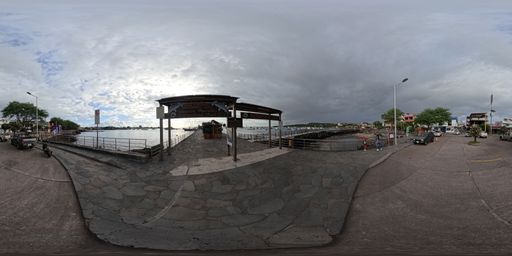
This scene is a image/jpeg type of scene.
It has links to these scenes:
Immersive 360-degree image showing the route along the Hammerhead Shark Pier. Access points to continue exploring the pier or return to the boardwalk route can be seen. via a hotspot placed at {"x":4953.844228154453,"y":-714.1957058477394,"z":658.3575628553722}
Immersive 360-degree image showing the route along the San Cristóbal boardwalk. Points of interest about land transportation and access to continue along the boardwalk can be seen. via a hotspot placed at {"x":-4726.204041776731,"y":-783.7600592697594,"z":-1592.4768951368078}
It also may have rich content in the form of Infospots.
A image infospot which contains
{"caption":"Educational image of the Hammerhead Shark Dock. An aerial view of a tourist dock surrounded by blue water and boats. Highlights its design inspired by this iconic species and its value as an embarkation point, tourist attraction, and connection to the sea.","previewText":"Infographic: Hammerhead Shark Dock","image":{"userId":133447,"assetId":"U7svvh-tf","name":"Pier.png","url":"https://gc.360-data.com/assets/133447/133447-Tk45nwLFqd-infospot.png","thumbUrl":"https://gc.360-data.com/assets/133447/133447-Tk45nwLFqd-thumb.png","assetType":"image","createdDate":null,"updatedDate":null,"shared":false,"copyCount":0,"numberOfUsesByTheOwner":0,"id":267906,"lastModifiedDate":"2026-06-23T14:08:55.490Z"}}
A html infospot which contains
the title of Sunset at Hammerhead Shark Dock and content
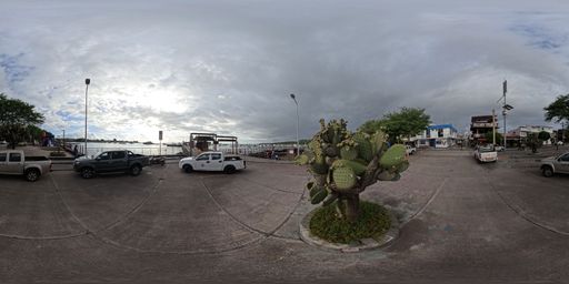
This scene is a image/jpeg type of scene.
It has links to these scenes:
Immersive 360-degree image showing the exit of the Hammerhead Shark Pier. Access points to continue the San Cristóbal boardwalk route can be seen. via a hotspot placed at {"x":4151.796751984715,"y":-432.0427197177647,"z":2836.8588668847733}
Immersive 360-degree image showing the route along the San Cristóbal boardwalk. A point of interest can be seen describing this area, which includes large letters and a map of the site. via a hotspot placed at {"x":-5041.571993156584,"y":-185.68320788945704,"z":152.1538969296216}
It also may have rich content in the form of Infospots.
A image infospot which contains
{"caption":"Educational image of land transport. A pickup-style taxi is seen in Puerto Baquerizo Moreno, with references to taxis, buses, and local destinations. Highlights its importance for the mobility of residents and visitors to beaches, docks, the airport, and visitor sites.","previewText":"Infographic: Land transport","image":{"userId":133447,"assetId":"5oZM3h1Wo","name":"B3220963-6B8E-4A61-A227-395070AEDFB9.png","url":"https://gc.360-data.com/assets/133447/133447-8dCZ4PkvAe-infospot.png","thumbUrl":"https://gc.360-data.com/assets/133447/133447-8dCZ4PkvAe-thumb.png","assetType":"image","createdDate":null,"updatedDate":null,"shared":false,"copyCount":0,"numberOfUsesByTheOwner":0,"id":267926,"lastModifiedDate":"2026-06-23T14:55:07.907Z"}}
A image infospot which contains
{"caption":"Land transport on San Cristóbal connects residents and visitors within Puerto Baquerizo Moreno and to more remote parts of the island. Taxis — typically white double-cab pickups — are the most common way to travel to the town center, the airport, the dock, nearby beaches, and visitor sites. Local bus services and private transport also connect different areas of the island.","previewText":"Land transport","image":{"userId":133447,"shared":false,"assetId":"f3n2kS-Z_","assetType":"image","name":"Trasnporte Taxi.jpg","url":"https://gc.360-data.com/assets/133447/133447-6P9OQnD-YA-infospot.jpg","thumbUrl":"https://gc.360-data.com/assets/133447/133447-6P9OQnD-YA-thumb.jpg","createdDate":null,"copyCount":0,"numberOfUsesByTheOwner":1,"picture":null,"userName":"Gabriela","tags":[]}}
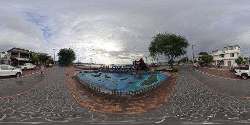
This scene is a image/jpeg type of scene.
It has links to these scenes:
Immersive 360-degree image showing the route along the San Cristóbal boardwalk. Points of interest about land transportation and access to continue along the boardwalk can be seen. via a hotspot placed at {"x":1197.8910089238327,"y":-381.6594344280417,"z":-4889.243482806549}
Immersive 360-degree image showing the route along the San Cristóbal boardwalk. A point of interest about the flora found in a nearby park can be seen. via a hotspot placed at {"x":-537.2822891662918,"y":-338.3138044141839,"z":5007.019910193151}
It also may have rich content in the form of Infospots.
A image infospot which contains
{"caption":"Educational image of the San Cristóbal sign. A colorful sign is seen on the waterfront alongside the sea, boats, and public spaces. Highlights its value as an emblematic point of local identity, photography, responsible tourism, and connection to the coastal landscape.","previewText":"Infographic: San Cristóbal letters","image":{"userId":133447,"assetId":"c91PtxuyY","name":"Sing.png","url":"https://gc.360-data.com/assets/133447/133447-_9hkoDlYnAK-infospot.png","thumbUrl":"https://gc.360-data.com/assets/133447/133447-_9hkoDlYnAK-thumb.png","assetType":"image","createdDate":null,"updatedDate":null,"shared":false,"copyCount":0,"numberOfUsesByTheOwner":0,"id":267907,"lastModifiedDate":"2026-06-23T14:13:30.531Z"}}
A image infospot which contains
{"caption":"The San Cristóbal Letters are a landmark on the waterfront of Puerto Baquerizo Moreno, where residents and visitors often stop to take photos and celebrate the island's identity. More than a tourist monument, this space reflects the connection between the local community, the coastal landscape, and the biodiversity that defines San Cristóbal.","previewText":"San Cristóbal letters","image":{"userId":133447,"shared":false,"assetId":"bzyIvDabc","assetType":"image","name":"Letras.jpg","url":"https://gc.360-data.com/assets/133447/133447-U50FkF8I0_-infospot.jpg","thumbUrl":"https://gc.360-data.com/assets/133447/133447-U50FkF8I0_-thumb.jpg","createdDate":null,"copyCount":0,"numberOfUsesByTheOwner":1,"picture":null,"userName":"Gabriela","tags":[]}}
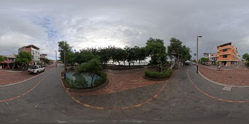
This scene is a image/jpeg type of scene.
It has links to these scenes:
Immersive 360-degree image showing the route along the San Cristóbal boardwalk. A point of interest can be seen describing this area, which includes large letters and a map of the site. via a hotspot placed at {"x":-580.5193244907641,"y":-211.16415618974204,"z":-5010.460973917684}
Immersive 360-degree image showing the route along the San Cristóbal boardwalk. A point of interest can be seen describing a playground located in this area. via a hotspot placed at {"x":-338.4407743180411,"y":-366.4341473843507,"z":5024.151061581405}
It also may have rich content in the form of Infospots.
A image infospot which contains
{"caption":"Educational image of Darwin's lecocarpus. An endemic plant is shown with large leaves, yellow flowers, and spiny fruits. Presents its uniqueness, its educational value, and the importance of conserving species that do not naturally occur anywhere else.","previewText":"Infographic: Darwin's lecocarpus","image":{"userId":133447,"assetId":"7gwYhmYjY","name":"DARWINILECOCARPUS.png","url":"https://gc.360-data.com/assets/133447/133447-zLgtL20WTd-infospot.png","thumbUrl":"https://gc.360-data.com/assets/133447/133447-zLgtL20WTd-thumb.png","assetType":"image","createdDate":null,"updatedDate":null,"shared":false,"copyCount":0,"numberOfUsesByTheOwner":0,"id":267908,"lastModifiedDate":"2026-06-23T14:15:47.311Z"}}
A image infospot which contains
{"caption":"Educational image of the opuntia cactus. A cactus with flat, fleshy pads, yellow flowers, colorful fruits, and spines is shown. Highlights its adaptation to the dry climate and its importance as a food source and shelter for birds, reptiles, and insects.","previewText":"Infographic: Opuntia Cactus","image":{"userId":133447,"assetId":"Sl9ZJwcH_","name":"PRICKLYPEARCACTUS.png","url":"https://gc.360-data.com/assets/133447/133447-tGdPJQ8yUG-infospot.png","thumbUrl":"https://gc.360-data.com/assets/133447/133447-tGdPJQ8yUG-thumb.png","assetType":"image","createdDate":null,"updatedDate":null,"shared":false,"copyCount":0,"numberOfUsesByTheOwner":0,"id":267909,"lastModifiedDate":"2026-06-23T14:16:57.391Z"}}
A image infospot which contains
{"caption":"Educational image of the candelabro cactus. A tall, branching cactus is shown with green stems, white flowers, red fruits, and spines. Presents its ability to store water, withstand drought, and serve as food and shelter for various species.","previewText":"Infographic: Candelabro Cactus","image":{"userId":133447,"assetId":"CvRgn9EIl","name":"CHANDELABRACACTUS.png","url":"https://gc.360-data.com/assets/133447/133447-tbqcLciUJ9-infospot.png","thumbUrl":"https://gc.360-data.com/assets/133447/133447-tbqcLciUJ9-thumb.png","assetType":"image","createdDate":null,"updatedDate":null,"shared":false,"copyCount":0,"numberOfUsesByTheOwner":0,"id":267910,"lastModifiedDate":"2026-06-23T14:17:56.870Z"}}
A image infospot which contains
{"caption":"Darwin's lecocarpus (\"Lecocarpus darwinii\") - is a plant endemic to Galápagos — meaning it does not grow naturally anywhere else in the world. It is a woody shrub with large, green, toothed leaves, yellow daisy-like flowers, and spiny fruits. Its name pays tribute to Charles Darwin, recalling the archipelago's importance in the study of evolution and the adaptation of species.","previewText":"Darwin's lecocarpus","image":{"userId":133447,"shared":false,"assetId":"BEOY7v-ee","assetType":"image","name":"Lecocarpus_1.jpg","url":"https://gc.360-data.com/assets/133447/133447-VyPzdby6lO-infospot.jpg","thumbUrl":"https://gc.360-data.com/assets/133447/133447-VyPzdby6lO-thumb.jpg","createdDate":null,"copyCount":0,"numberOfUsesByTheOwner":1,"picture":null,"userName":"Gabriela","tags":[]}}
A image infospot which contains
{"caption":"Covered in long spines for defense and glochids — tiny barbed bristles that cause severe irritation on contact — protecting its fruits and flowers.","previewText":"Opuntia Cactus","image":{"userId":133447,"shared":false,"assetId":"tRVTxwIS9","assetType":"image","name":"Frutos Opuntia.jpg","url":"https://gc.360-data.com/assets/133447/133447-6qWMSOpp7SH-infospot.jpg","thumbUrl":"https://gc.360-data.com/assets/133447/133447-6qWMSOpp7SH-thumb.jpg","createdDate":null,"copyCount":0,"numberOfUsesByTheOwner":1,"picture":null,"userName":"Gabriela","tags":[]}}
A image infospot which contains
{"caption":"Deep green in color, blending with its branches. As they ripen, the fruits turn a deep purplish-red, making them highly visible to birds.","previewText":"Candelabro Cactus ","image":{"userId":133447,"shared":false,"assetId":"AoiJRts_8","assetType":"image","name":"Fruto de Catus candelabro.jpg","url":"https://gc.360-data.com/assets/133447/133447-lr9J_wnMFu-infospot.jpg","thumbUrl":"https://gc.360-data.com/assets/133447/133447-lr9J_wnMFu-thumb.jpg","createdDate":null,"copyCount":0,"numberOfUsesByTheOwner":2,"picture":null,"userName":"Gabriela","tags":[]}}
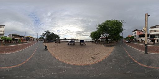
This scene is a image/jpeg type of scene.
It has links to these scenes:
Immersive 360-degree image showing the route along the San Cristóbal boardwalk. A point of interest about the flora found in a nearby park can be seen. via a hotspot placed at {"x":-319.179921637466,"y":-188.1031786566611,"z":-5036.129236414691}
Immersive 360-degree image showing the route along the San Cristóbal boardwalk. Points of interest describing the municipal building and Playa de los Marinos can be seen. via a hotspot placed at {"x":-199.09480178527792,"y":-193.04968393699338,"z":5039.95219195179}
It also may have rich content in the form of Infospots.
A image infospot which contains
{"caption":"Educational image of the children's park. A recreational space is shown with play equipment, green areas, murals, and benches. Presents its importance for family life, play, socialization, and the well-being of children and families in the community.","previewText":"Infographic: Children's park","image":{"userId":133447,"assetId":"24gyMFp5x","name":"Childtenpark.png","url":"https://gc.360-data.com/assets/133447/133447-cbF7d21NNI-infospot.png","thumbUrl":"https://gc.360-data.com/assets/133447/133447-cbF7d21NNI-thumb.png","assetType":"image","createdDate":null,"updatedDate":null,"shared":false,"copyCount":0,"numberOfUsesByTheOwner":0,"id":267911,"lastModifiedDate":"2026-06-23T14:19:37.607Z"}}
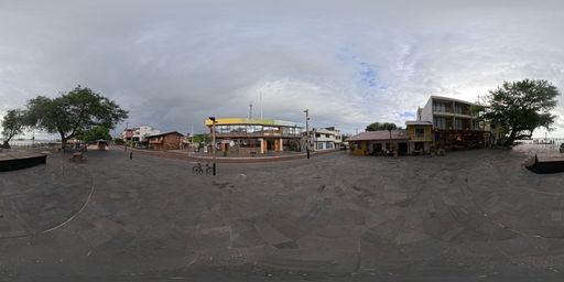
This scene is a image/jpeg type of scene.
It has links to these scenes:
Immersive 360-degree image showing Playa de los Marinos on the San Cristóbal boardwalk. Points of interest about local sea lions and tourism activity can be seen. via a hotspot placed at {"x":-4195.896465280291,"y":-138.61006172110427,"z":2801.084543459099}
Immersive 360-degree image showing the route along the San Cristóbal boardwalk. A point of interest can be seen describing a playground located in this area. via a hotspot placed at {"x":-1635.2257103061813,"y":-202.64974043157878,"z":4771.534765176153}
Immersive 360-degree image showing the route along the San Cristóbal boardwalk. Points of interest about the flora found in this area can be seen. via a hotspot placed at {"x":3938.1104237452882,"y":-468.12586757552185,"z":-3121.438813466089}
It also may have rich content in the form of Infospots.
A image infospot which contains
{"caption":"Educational image of San Cristóbal Municipality. The municipal building and its urban surroundings are shown. Highlights its role in local planning, public services, environmental management, community development, and promoting a more sustainable territory.","previewText":"Infographic: San Cristóbal Municipality","image":{"userId":133447,"assetId":"SSyVTvZ9F","name":"Municipal.png","url":"https://gc.360-data.com/assets/133447/133447-X4_bY0xLvk-infospot.png","thumbUrl":"https://gc.360-data.com/assets/133447/133447-X4_bY0xLvk-thumb.png","assetType":"image","createdDate":null,"updatedDate":null,"shared":false,"copyCount":0,"numberOfUsesByTheOwner":0,"id":267912,"lastModifiedDate":"2026-06-23T14:21:46.162Z"}}
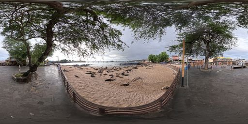
This scene is a image/jpeg type of scene.
It has links to these scenes:
Immersive 360-degree image showing the route along the San Cristóbal boardwalk. Points of interest describing the municipal building and Playa de los Marinos can be seen. via a hotspot placed at {"x":-4770.201291454029,"y":-276.37568572293145,"z":-1626.100157838867}
It also may have rich content in the form of Infospots.
A image infospot which contains
{"caption":"Sea lions on the island are its most sociable and numerous inhabitants, gathering in urban areas and on beaches where they rest and interact with tourists.","previewText":"Sea lions at marinos beach","image":{"userId":133447,"assetId":"vOL7mlnYD","name":"Lobo playa de los marinos.jpg","url":"https://gc.360-data.com/assets/133447/133447-5esISQ9yTtW-infospot.jpg","thumbUrl":"https://gc.360-data.com/assets/133447/133447-5esISQ9yTtW-thumb.jpg","assetType":"image","createdDate":null,"updatedDate":null,"shared":false,"copyCount":0,"numberOfUsesByTheOwner":0,"id":263692,"lastModifiedDate":"2026-05-14T16:50:14.755Z"}}
A image infospot which contains
{"caption":"Educational image of tourists and nature. A group of visitors is seen photographing a sea lion on the waterfront. Highlights the importance of observing wildlife with respect — maintaining distance, not touching or feeding animals, and following the National Park regulations.","previewText":"Infographic: Tourists and nature","image":{"userId":133447,"assetId":"OeIFUg7DG","name":"TURISTSANDNATURE.png","url":"https://gc.360-data.com/assets/133447/133447-ZjhLjv9fydm-infospot.png","thumbUrl":"https://gc.360-data.com/assets/133447/133447-ZjhLjv9fydm-thumb.png","assetType":"image","createdDate":null,"updatedDate":null,"shared":false,"copyCount":0,"numberOfUsesByTheOwner":0,"id":267913,"lastModifiedDate":"2026-06-23T14:22:33.962Z"}}
A image infospot which contains
{"caption":"Species can be observed in their natural environment, drawing visitors' attention due to how easily accessible they are.","previewText":"Tourists and nature","image":{"userId":133447,"shared":false,"assetId":"8z4O0Yip4","assetType":"image","name":"Turistas y naturaleza.jpg","url":"https://gc.360-data.com/assets/133447/133447-XDzThMiPmw-infospot.jpg","thumbUrl":"https://gc.360-data.com/assets/133447/133447-XDzThMiPmw-thumb.jpg","createdDate":null,"copyCount":0,"numberOfUsesByTheOwner":1,"picture":null,"userName":"Gabriela","tags":[]}}
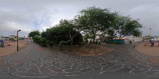
This scene is a image/jpeg type of scene.
It has links to these scenes:
Immersive 360-degree image showing the route along the San Cristóbal boardwalk. Points of interest describing the municipal building and Playa de los Marinos can be seen. via a hotspot placed at {"x":-1094.9493071852412,"y":-261.09321566583344,"z":-4919.535626955278}
Immersive 360-degree image showing the route along the San Cristóbal boardwalk. A bridge over a water channel can be seen, along with several points of interest about the local flora and fauna. via a hotspot placed at {"x":-1463.6112754003193,"y":-101.86379438639808,"z":4828.91255747806}
It also may have rich content in the form of Infospots.
A image infospot which contains
{"caption":"Mesquite tree (\"Prosopis juliflora\") - A deciduous tree that can reach 5 to 10 meters in height, with a wide, spreading canopy.","previewText":"Mesquite tree leaf","image":{"userId":133447,"assetId":"e6V1XtFew","name":"Algarrobo Hoja_2.jpg","url":"https://gc.360-data.com/assets/133447/133447-GakbIjn0KI-infospot.jpg","thumbUrl":"https://gc.360-data.com/assets/133447/133447-GakbIjn0KI-thumb.jpg","assetType":"image","createdDate":null,"updatedDate":null,"shared":false,"copyCount":0,"numberOfUsesByTheOwner":0,"id":263694,"lastModifiedDate":"2026-05-14T16:59:18.636Z"}}
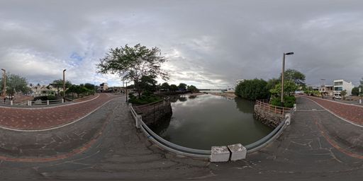
This scene is a image/jpeg type of scene.
It has links to these scenes:
Immersive 360-degree image showing the route along the San Cristóbal boardwalk. Points of interest about the flora found in this area can be seen. via a hotspot placed at {"x":-2180.9289457991226,"y":-512.1122929452158,"z":-4523.444164168839}
Immersive 360-degree image showing the route along the San Cristóbal boardwalk. Points of interest about a small beach located next to the boardwalk can be seen. via a hotspot placed at {"x":3546.84223650287,"y":-250.7985151568861,"z":3581.529349362299}
It also may have rich content in the form of Infospots.
A image infospot which contains
{"caption":"Educational image of the water channel. It shows a natural channel or temporary water outlet towards the beach, surrounded by walls, vegetation, and an urban area. It illustrates its function in rainwater drainage, preventing water accumulation, and maintaining the natural balance of the area.","previewText":"Infographic: Water channel","image":{"userId":133447,"assetId":"znWbnSG4e","name":"DITCH.png","url":"https://gc.360-data.com/assets/133447/133447-ZGFU_B9OTG-infospot.png","thumbUrl":"https://gc.360-data.com/assets/133447/133447-ZGFU_B9OTG-thumb.png","assetType":"image","createdDate":null,"updatedDate":null,"shared":false,"copyCount":0,"numberOfUsesByTheOwner":0,"id":267917,"lastModifiedDate":"2026-06-23T14:33:39.674Z"}}
A image infospot which contains
{"caption":"A water accumulation formed by wastewater discharge and runoff from heavy rainfall.","previewText":"Waterfront pool","image":{"userId":133447,"assetId":"COF-OPjEM","name":"poza.jpg","url":"https://gc.360-data.com/assets/133447/133447-PGztAGiZLm-infospot.jpg","thumbUrl":"https://gc.360-data.com/assets/133447/133447-PGztAGiZLm-thumb.jpg","assetType":"image","createdDate":null,"updatedDate":null,"shared":false,"copyCount":0,"numberOfUsesByTheOwner":0,"id":263697,"lastModifiedDate":"2026-05-14T17:08:38.639Z"}}
A image infospot which contains
{"caption":"Educational image of the red mangrove. A coastal tree is shown with prop roots over the water, green leaves, and propagules. Presents its function as shelter for marine fauna, coastal protector, and natural filter that helps keep the ecosystem healthy.","previewText":"Infographic: Red Mangrove","image":{"userId":133447,"assetId":"hhcBQaafT","name":"REDMANGROVE.png","url":"https://gc.360-data.com/assets/133447/133447-J9qcsJ4LrN-infospot.png","thumbUrl":"https://gc.360-data.com/assets/133447/133447-J9qcsJ4LrN-thumb.png","assetType":"image","createdDate":null,"updatedDate":null,"shared":false,"copyCount":0,"numberOfUsesByTheOwner":0,"id":267916,"lastModifiedDate":"2026-06-23T14:29:39.645Z"}}
A image infospot which contains
{"caption":"Prefers mangrove areas, rocky coasts, and brackish lagoons. Commonly seen among the prop roots of red mangroves, where it seeks shelter and nests.","previewText":"Yellow-crowned night heron","image":{"userId":133447,"assetId":"wjJgmIlxU","name":"Garza.jpg","url":"https://gc.360-data.com/assets/133447/133447-C-PQ8oG1W2-infospot.jpg","thumbUrl":"https://gc.360-data.com/assets/133447/133447-C-PQ8oG1W2-thumb.jpg","assetType":"image","createdDate":null,"updatedDate":null,"shared":false,"copyCount":0,"numberOfUsesByTheOwner":0,"id":263793,"lastModifiedDate":"2026-05-15T17:21:37.763Z"}}
A image infospot which contains
{"caption":"Representation of a land turtle feeding on the prickly pear (fruit of the opuntia) implying its long neck extension to reach its favorite food.","previewText":"Sculpture of a turtle and prickly pear cactus","image":{"userId":133447,"assetId":"dEll7dVET","name":"Escultura de Tortuga y tuna.jpg","url":"https://gc.360-data.com/assets/133447/133447-VauE5S3abs-infospot.jpg","thumbUrl":"https://gc.360-data.com/assets/133447/133447-VauE5S3abs-thumb.jpg","assetType":"image","createdDate":null,"updatedDate":null,"shared":false,"copyCount":0,"numberOfUsesByTheOwner":0,"id":263795,"lastModifiedDate":"2026-05-15T17:22:59.809Z"}}
A image infospot which contains
{"caption":"The red mangrove is a biological engineer that has developed unique structures to survive in unstable, saline soils.","previewText":"Mangrove seed","image":{"userId":133447,"shared":false,"assetId":"5CfdUoJqg","assetType":"image","name":"Mangle_Semilla.jpg","url":"https://gc.360-data.com/assets/133447/133447-uPC18vbpNi-infospot.jpg","thumbUrl":"https://gc.360-data.com/assets/133447/133447-uPC18vbpNi-thumb.jpg","createdDate":null,"copyCount":0,"numberOfUsesByTheOwner":1,"picture":null,"userName":"Gabriela","tags":[]}}
A image infospot which contains
{"caption":"The red mangrove is a biological engineer that has developed unique structures to survive in unstable, saline soils.","previewText":"Mangrove leaf ","image":{"userId":133447,"shared":false,"assetId":"x48TTRej9","assetType":"image","name":"Mangle_Hoja.jpg","url":"https://gc.360-data.com/assets/133447/133447-s3elbUJEdf-infospot.jpg","thumbUrl":"https://gc.360-data.com/assets/133447/133447-s3elbUJEdf-thumb.jpg","createdDate":null,"copyCount":0,"numberOfUsesByTheOwner":1,"picture":null,"userName":"Gabriela","tags":[]}}
A image infospot which contains
{"caption":"","previewText":"Infographic: Land tortoise","image":{"userId":133447,"assetId":"I6H7MLKO_","name":"CBA19BA4-4FD4-4E60-8406-032E8DB6B210.png","url":"https://gc.360-data.com/assets/133447/133447-8GHTFSbE-y-infospot.png","thumbUrl":"https://gc.360-data.com/assets/133447/133447-8GHTFSbE-y-thumb.png","assetType":"image","createdDate":null,"updatedDate":null,"shared":false,"copyCount":0,"numberOfUsesByTheOwner":0,"id":267927,"lastModifiedDate":"2026-06-23T14:55:43.685Z"}}
A image infospot which contains
{"caption":"Educational image of the Waterfront Pool. A natural pool surrounded by rocks is shown, close to the urban area and the sea. Highlights its use as a recreational space and as a resting area for sea lions, especially pups and juveniles.","previewText":"Infographic: Waterfront Pool","image":{"userId":133447,"assetId":"G-uIJ-pFs","name":"Malecon Pool.png","url":"https://gc.360-data.com/assets/133447/133447-M41kuRjsSo-infospot.png","thumbUrl":"https://gc.360-data.com/assets/133447/133447-M41kuRjsSo-thumb.png","assetType":"image","createdDate":null,"updatedDate":null,"shared":false,"copyCount":0,"numberOfUsesByTheOwner":0,"id":267914,"lastModifiedDate":"2026-06-23T14:26:26.930Z"}}
A image infospot which contains
{"caption":"Red Mangrove (\"Rhizophora mangle\") - The red mangrove is one of the most representative species of Galápagos mangroves. It is considered a \"biological engineer\" because its aerial roots — known as prop roots — help anchor the plant in muddy, unstable, low-oxygen soils. These roots also trap sediments, reduce erosion, and create natural refuges for juvenile fish, crustaceans, birds, and other coastal organisms.","previewText":"Red Mangrove","image":{"userId":133447,"shared":false,"assetId":"AxRhnr7DN","assetType":"image","name":"Mangle_PG.jpg","url":"https://gc.360-data.com/assets/133447/133447-6FvBaEsY74-infospot.jpg","thumbUrl":"https://gc.360-data.com/assets/133447/133447-6FvBaEsY74-thumb.jpg","createdDate":null,"copyCount":0,"numberOfUsesByTheOwner":1,"picture":null,"userName":"Gabriela","tags":[]}}
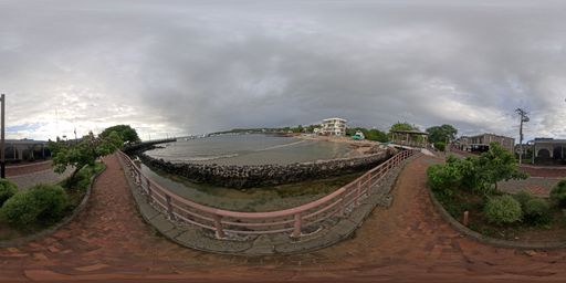
This scene is a image/jpeg type of scene.
It has links to these scenes:
Immersive 360-degree image showing the route along the San Cristóbal boardwalk. A bridge over a water channel can be seen, along with several points of interest about the local flora and fauna. via a hotspot placed at {"x":-1258.909160572183,"y":-442.90632279160116,"z":-4869.47680089533}
Immersive 360-degree image showing one end of the boardwalk route. Points of interest about a naval base located in this sector can be seen. via a hotspot placed at {"x":-1548.3374690677283,"y":-708.731212465355,"z":4753.11960740934}
It also may have rich content in the form of Infospots.
A ext infospot which contains
{"h1":"Marinos beach","h2":"Playa de los Marinos, located in Puerto Baquerizo Moreno, San Cristóbal, is a key wildlife observation point in Galápagos. It is known for hosting a large sea lion colony and is an ideal spot to watch them rest, especially at sunset. It is located near the main dock and forms part of the island's urban coastal landscape."}
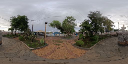
This scene is a image/jpeg type of scene.
It has links to these scenes:
Immersive 360-degree image showing the route along the San Cristóbal boardwalk. Points of interest about a small beach located next to the boardwalk can be seen. via a hotspot placed at {"x":4464.892354037377,"y":-658.6878583329133,"z":-2258.3500615226826}
Immersive 360-degree image showing the main section of the San Cristóbal boardwalk. Access points to explore the boardwalk or visit the pier can be seen. via a hotspot placed at {"x":-3284.4777933024066,"y":-3787.8065248454354,"z":-593.3245924962594}
It also may have rich content in the form of Infospots.
A image infospot which contains
{"caption":"Educational image of San Cristóbal Naval Base. The entrance of the institution is shown with elements associated with the Navy. Presents its importance for maritime security, sovereignty, territorial control, and emergency response in a province surrounded by the ocean.","previewText":"Infographic: Naval Base","image":{"userId":133447,"assetId":"UyQWINlOA","name":"NAVALBASE.png","url":"https://gc.360-data.com/assets/133447/133447-iUcBjIy_QTE-infospot.png","thumbUrl":"https://gc.360-data.com/assets/133447/133447-iUcBjIy_QTE-thumb.png","assetType":"image","createdDate":null,"updatedDate":null,"shared":false,"copyCount":0,"numberOfUsesByTheOwner":0,"id":267919,"lastModifiedDate":"2026-06-23T14:36:26.299Z"}}
A image infospot which contains
{"caption":"San Cristóbal Naval Base, known as BASCRI, is a strategic point of the Ecuadorian Navy in Galápagos. Its location in Puerto Baquerizo Moreno supports actions related to maritime sovereignty, aquatic space security, territorial control, and emergency response in a province entirely surrounded by the ocean.","previewText":"Naval Base","image":{"userId":133447,"shared":false,"assetId":"L6PC69pz4","assetType":"image","name":"Base naval.jpg","url":"https://gc.360-data.com/assets/133447/133447-b-4-RfNvaE-infospot.jpg","thumbUrl":"https://gc.360-data.com/assets/133447/133447-b-4-RfNvaE-thumb.jpg","createdDate":null,"copyCount":0,"numberOfUsesByTheOwner":1,"picture":null,"userName":"Gabriela","tags":[]}}
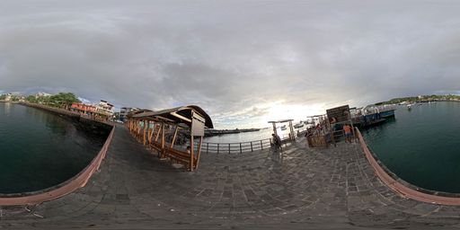
This scene is a image/jpeg type of scene.
It has links to these scenes:
Immersive 360-degree image showing the main section of the San Cristóbal boardwalk. Access points to explore the boardwalk or visit the pier can be seen. via a hotspot placed at {"x":287.15457433608697,"y":-550.1920691262266,"z":5010.243125180207}
Immersive 360-degree image showing the far end of the Aquarium Pier. Points of interest describing different types of boats located in the area can be seen. via a hotspot placed at {"x":-2777.0273239491908,"y":443.886511320333,"z":-4191.048501847519}
It also may have rich content in the form of Infospots.
A image infospot which contains
{"caption":"The Aquarium Dock on San Cristóbal Island is a key embarkation point, frequently used by tour operators for daily tours and excursions, and also receives passengers from other islands when the main dock is undergoing maintenance.","previewText":"Aquarium Dock ","image":{"userId":133447,"assetId":"8Dy86O70K","name":"Muella Acuario.jpg","url":"https://gc.360-data.com/assets/133447/133447-vtwweqIjh0-infospot.jpg","thumbUrl":"https://gc.360-data.com/assets/133447/133447-vtwweqIjh0-thumb.jpg","assetType":"image","createdDate":null,"updatedDate":null,"shared":false,"copyCount":0,"numberOfUsesByTheOwner":0,"id":263702,"lastModifiedDate":"2026-05-14T17:22:46.071Z"}}
A ext infospot which contains
{"h1":"Boat waiting area","h2":"A resting spot for tourists waiting for their tours and for members of the local community."}
A image infospot which contains
{"caption":"Educational image of a diving student. A person is seen learning to dive underwater, using specialized equipment alongside nearby marine fauna. Highlights safe training, marine conservation, and responsible practices for exploring the underwater world without harming the ecosystem.","previewText":"Infographic: Diving student","image":{"userId":133447,"assetId":"itxBjCXVy","name":"DIVINGSTUDENT.png","url":"https://gc.360-data.com/assets/133447/133447-83GBXuIll_C-infospot.png","thumbUrl":"https://gc.360-data.com/assets/133447/133447-83GBXuIll_C-thumb.png","assetType":"image","createdDate":null,"updatedDate":null,"shared":false,"copyCount":0,"numberOfUsesByTheOwner":0,"id":267920,"lastModifiedDate":"2026-06-23T14:37:27.582Z"}}
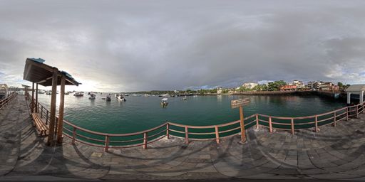
This scene is a image/jpeg type of scene.
It has links to these scenes:
Immersive 360-degree image showing the Aquarium Pier. Access points to continue the pier route and information about diving activities can be seen. via a hotspot placed at {"x":-4284.450909846291,"y":49.14561709123123,"z":-2669.2062068670366}
It also may have rich content in the form of Infospots.
A image infospot which contains
{"caption":"Educational image of a daily tour boat. A tourist vessel carrying passengers is seen navigating clear waters. Highlights its role in visiting natural sites in a regulated manner, promoting environmental education, and protecting species and habitats through responsible practices.","previewText":"Infographic: Daily tour boat","image":{"userId":133447,"assetId":"VSN7Lbz-j","name":"TOURBOAT.png","url":"https://gc.360-data.com/assets/133447/133447-TTibfB78Vr-infospot.png","thumbUrl":"https://gc.360-data.com/assets/133447/133447-TTibfB78Vr-thumb.png","assetType":"image","createdDate":null,"updatedDate":null,"shared":false,"copyCount":0,"numberOfUsesByTheOwner":0,"id":267921,"lastModifiedDate":"2026-06-23T14:39:43.540Z"}}
A ext infospot which contains
{"h1":"Dive boats","h2":"Boats used to transport tourists to designated diving sites."}
A image infospot which contains
{"caption":"Daily tour boats transport visitors from the inhabited islands to more remote natural sites, where activities such as interpretive walks, snorkeling, wildlife observation, landscape photography, and marine-coastal tours take place. In Galápagos, many visitor sites can only be reached by sea, making these vessels essential for connecting the port with protected natural areas.","previewText":"Daily tour boat","image":{"userId":133447,"shared":false,"assetId":"cB-QAsPFU","assetType":"image","name":"Lancha de Tour navegable.jpg","url":"https://gc.360-data.com/assets/133447/133447-ZRSKewhOPf-infospot.jpg","thumbUrl":"https://gc.360-data.com/assets/133447/133447-ZRSKewhOPf-thumb.jpg","createdDate":null,"copyCount":0,"numberOfUsesByTheOwner":2,"picture":null,"userName":"Gabriela","tags":[]}}
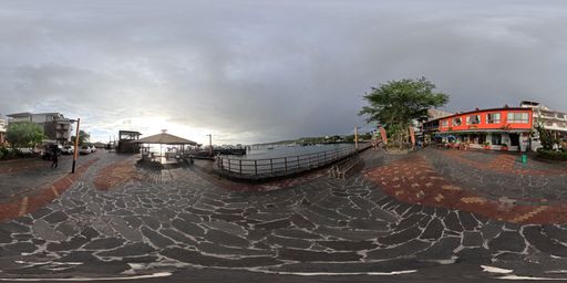
This scene is a image/jpeg type of scene.
It has links to these scenes:
Immersive 360-degree image showing the main section of the San Cristóbal boardwalk. Access points to explore the boardwalk or visit the pier can be seen. via a hotspot placed at {"x":-873.4374517171566,"y":-712.5349046362193,"z":4920.011388395429}
Immersive 360-degree image showing one end of the boardwalk route. Points of interest about Charles Darwin and Playa de Oro can be seen. via a hotspot placed at {"x":2398.342181268145,"y":-40.943639180344185,"z":-4442.032398739815}
It also may have rich content in the form of Infospots.
A image infospot which contains
{"caption":"Educational image of the brown pelican. A large seabird is shown on coastal rocks, with details of its beak, plumage, webbed feet, and diving. It highlights its role in the marine ecosystem and the importance of observing it without feeding or disturbing it.","previewText":"Infographic: Brown Pelican","image":{"userId":133447,"assetId":"XlJ4otq-p","name":"BROWNPELICAN.png","url":"https://gc.360-data.com/assets/133447/133447-SqyLli6tym0-infospot.png","thumbUrl":"https://gc.360-data.com/assets/133447/133447-SqyLli6tym0-thumb.png","assetType":"image","createdDate":null,"updatedDate":null,"shared":false,"copyCount":0,"numberOfUsesByTheOwner":0,"id":267922,"lastModifiedDate":"2026-06-23T14:42:42.101Z"}}
A image infospot which contains
{"caption":"Blue-footed Boobies can often be found resting on the rocks near the dock, just a few meters from human observers.","previewText":"Blue-footed Booby","image":{"userId":133447,"assetId":"FbokOTR3f","name":"Piquero en malecón.jpg","url":"https://gc.360-data.com/assets/133447/133447-NMb1MJkOqc-infospot.jpg","thumbUrl":"https://gc.360-data.com/assets/133447/133447-NMb1MJkOqc-thumb.jpg","assetType":"image","createdDate":null,"updatedDate":null,"shared":false,"copyCount":0,"numberOfUsesByTheOwner":0,"id":263704,"lastModifiedDate":"2026-05-14T17:32:19.931Z"}}
A image infospot which contains
{"caption":"The main fishermen's dock on San Cristóbal, known as the \"Jesús de los Mares\" dock, is the site of artisanal boat loading and unloading activities.","previewText":"Fishermen's dock","image":{"userId":133447,"shared":false,"assetId":"Jv_RVT62R","assetType":"image","name":"Muelle de pescadores.jpg","url":"https://gc.360-data.com/assets/133447/133447-uqURRV8Iyl-infospot.jpg","thumbUrl":"https://gc.360-data.com/assets/133447/133447-uqURRV8Iyl-thumb.jpg","createdDate":null,"copyCount":0,"numberOfUsesByTheOwner":1,"picture":null,"userName":"Gabriela","tags":[]}}
A image infospot which contains
{"caption":"Galapagos Brown Pelican (\"Pelecanus occidentalis urinator\") is a resident subspecies of the archipelago, easily observed at docks, bays, beaches, and fishing areas. Its presence near ports makes it one of the most charismatic seabirds for residents and visitors, but also a good example of how coastal species depend on the balance between the ocean, fish availability, and human activities.","previewText":"Galapagos Brown Pelican","image":{"userId":133447,"shared":false,"assetId":"XFfTUPDHP","assetType":"image","name":"Pelícano.jpg","url":"https://gc.360-data.com/assets/133447/133447-3y0GrjMQlC-infospot.jpg","thumbUrl":"https://gc.360-data.com/assets/133447/133447-3y0GrjMQlC-thumb.jpg","createdDate":null,"copyCount":0,"numberOfUsesByTheOwner":1,"picture":null,"userName":"Gabriela","tags":[]}}
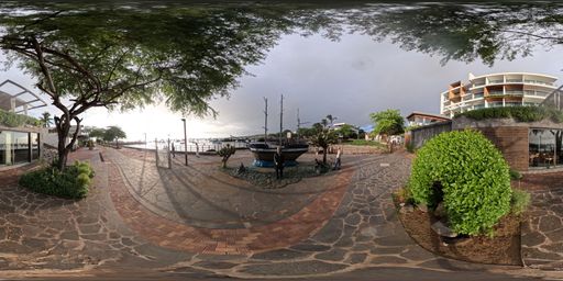
This scene is a image/jpeg type of scene.
It has links to these scenes:
Immersive 360-degree image showing the route along the San Cristóbal boardwalk. Points of interest about local birds and the fishermen’s pier can be seen. via a hotspot placed at {"x":-1641.3721985323007,"y":-158.65505250690552,"z":4770.422953611728}
It also may have rich content in the form of Infospots.
A image infospot which contains
{"caption":"Educational image of Playa de Oro. A rocky beach near the waterfront is shown, with the sea, boats, and the urban area in the background. Presents its importance as a resting area for sea lions and as a space for responsible interaction between the community, visitors, and wildlife.","previewText":"Infographic: Playa de Oro","image":{"userId":133447,"assetId":"R5zn1opIS","name":"F3211696-A749-40DE-9F1A-EBF9C2916A59.png","url":"https://gc.360-data.com/assets/133447/133447-Mj6x6_quRK-infospot.png","thumbUrl":"https://gc.360-data.com/assets/133447/133447-Mj6x6_quRK-thumb.png","assetType":"image","createdDate":null,"updatedDate":null,"shared":false,"copyCount":0,"numberOfUsesByTheOwner":0,"id":267928,"lastModifiedDate":"2026-06-23T14:56:13.323Z"}}
A image infospot which contains
{"caption":"A commemorative statue of Charles Darwin, who revolutionized science by demonstrating that species are not immutable but evolve over time through natural selection.","previewText":"Charles Darwin","image":{"userId":133447,"assetId":"STOjPKeib","name":"Charles Darwin.jpg","url":"https://gc.360-data.com/assets/133447/133447-5ZTNKhgT1d-infospot.jpg","thumbUrl":"https://gc.360-data.com/assets/133447/133447-5ZTNKhgT1d-thumb.jpg","assetType":"image","createdDate":null,"updatedDate":null,"shared":false,"copyCount":0,"numberOfUsesByTheOwner":0,"id":263707,"lastModifiedDate":"2026-05-14T17:39:35.348Z"}}
A image infospot which contains
{"caption":"","previewText":"Detail of the commemorative plaque","image":{"userId":133447,"assetId":"p2bw5_GkX","name":"INFO PLACA.png","url":"https://gc.360-data.com/assets/133447/133447-SL1zZhZJ5D-infospot.png","thumbUrl":"https://gc.360-data.com/assets/133447/133447-SL1zZhZJ5D-thumb.png","assetType":"image","createdDate":null,"updatedDate":null,"shared":false,"copyCount":0,"numberOfUsesByTheOwner":0,"id":263708,"lastModifiedDate":"2026-05-14T17:41:16.120Z"}}
A image infospot which contains
{"caption":"Educational image of Charles Darwin. A statue is shown alongside a vessel reminiscent of the HMS Beagle. Presents Darwin's arrival in Galápagos, his observations of nature, and the historical and scientific importance of his studies on evolution.","previewText":"Infographic: Charles Darwin","image":{"userId":133447,"assetId":"NZffKaX0X","name":"CHARLESDARWIN.png","url":"https://gc.360-data.com/assets/133447/133447-88p-abrvAin-infospot.png","thumbUrl":"https://gc.360-data.com/assets/133447/133447-88p-abrvAin-thumb.png","assetType":"image","createdDate":null,"updatedDate":null,"shared":false,"copyCount":0,"numberOfUsesByTheOwner":0,"id":267923,"lastModifiedDate":"2026-06-23T14:44:50.909Z"}}
A image infospot which contains
{"caption":"Playa de Oro is a small rocky beach located along the waterfront of Puerto Baquerizo Moreno, close to restaurants, hotels, and everyday transit areas. It is known for the frequent presence of Galápagos sea lions (Zalophus wollebaeki), which use the beach and its surroundings as a resting area, particularly during quieter hours. It is described locally as a central, easily accessible spot for observing sea lions on San Cristóbal.","previewText":"Playa de Oro","image":{"userId":133447,"shared":false,"assetId":"FlgRQ0yEb","assetType":"image","name":"Playa de Oro.jpg","url":"https://gc.360-data.com/assets/133447/133447-VQJtqtkkvt-infospot.jpg","thumbUrl":"https://gc.360-data.com/assets/133447/133447-VQJtqtkkvt-thumb.jpg","createdDate":null,"copyCount":0,"numberOfUsesByTheOwner":1,"picture":null,"userName":"Gabriela","tags":[]}}
This tour was created on Mon Jun 22 2026 15:17:17 GMT+0000 (Coordinated Universal Time)